Skip to content Skip to navigation
  • Karten
  • Unterricht
  • Shop
  • Info
  • Premium-Bereich
  • Maps
  • Shop
  • Info
Karte der Woche

Search filter

type

Karte (48)

topic

Europe (43)

Western and Central Europe (2)

Northern Europe (1)

South Eastern Europe (1)

South Western Europe (1)

    Keywords

  • Blue Banana
  • Carboniferous
  • Charlemagne
  • Christianity
  • Christians
  • Continental System
  • East Germany
  • European Union
  • Franks
  • GDR
  • German Confederation
  • German Democratic Republic
  • Greeks
  • Gulf Stream
  • Hanse
  • Hanseatic League
  • Hi-tech industry
  • High-tech industry
  • Holy Roman Empire
  • Iron Curtain
  • Islam
  • Limes
  • Mid-Latitudes
  • Middle Ages
  • NATO
  • Napoleon
  • North Atlantic Treaty Organization
  • North Atlantic Pact
  • Quaternary
  • Romans
  • Roman Empire
  • Schengen Area
  • Soviet Union
  • Subtropical Zone
  • Vikings
  • Weimar Republic
  • World War One
  • World War Two
  • absolutism
  • age structure
  • agglomeration
  • agriculture
  • airport
  • alliances
  • alpine transit
  • amusement park
  • animal husbandry
  • annual precipitation
  • antiquity
  • area under cultivation
  • aridity
  • asylum seekers
  • baroque
  • bedrock
  • border
  • boreal forest
  • capital
  • cave-painting
  • climate change
  • climate graph
  • climate zones
  • climatic graph
  • cold period
  • commodities
  • cruise
  • crusades
  • cultivation boundary
  • deciduous forest
  • delta
  • demographic transition
  • directions
  • drought
  • drought damage
  • early modern period
  • earthquake risk
  • economic alliances
  • economic centre
  • electricity generation
  • emperor
  • empire
  • financial centre
  • history map
  • innovation centre
  • island
  • kingdom
  • loess
  • precipitation
  • pull factors
  • push factors
  • seasonal climate
  • soils
  • spa
  • summer tourism
  • temperature
  • theme park
  • trade
  • types of tourism
  • winds
  • wind systems
  • winter tourism

Your search

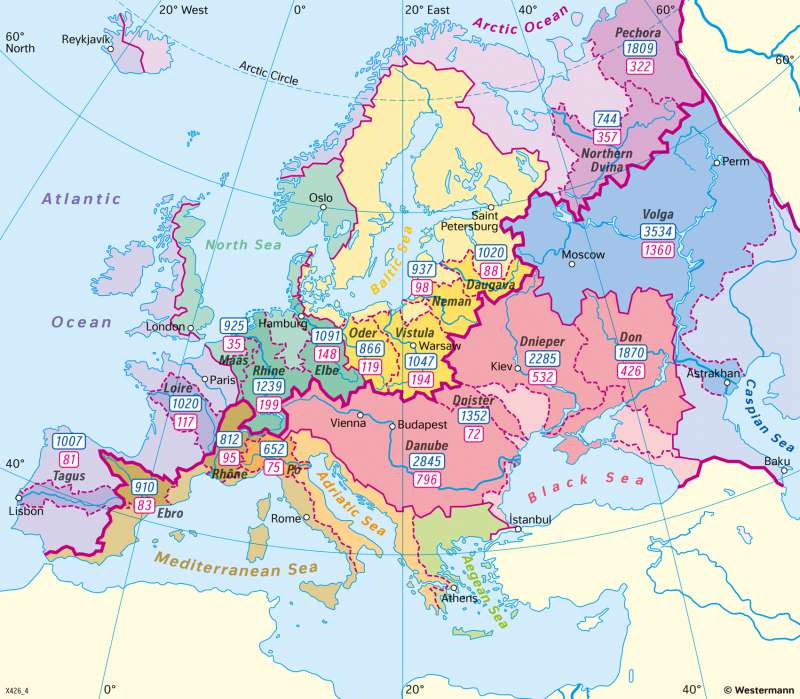
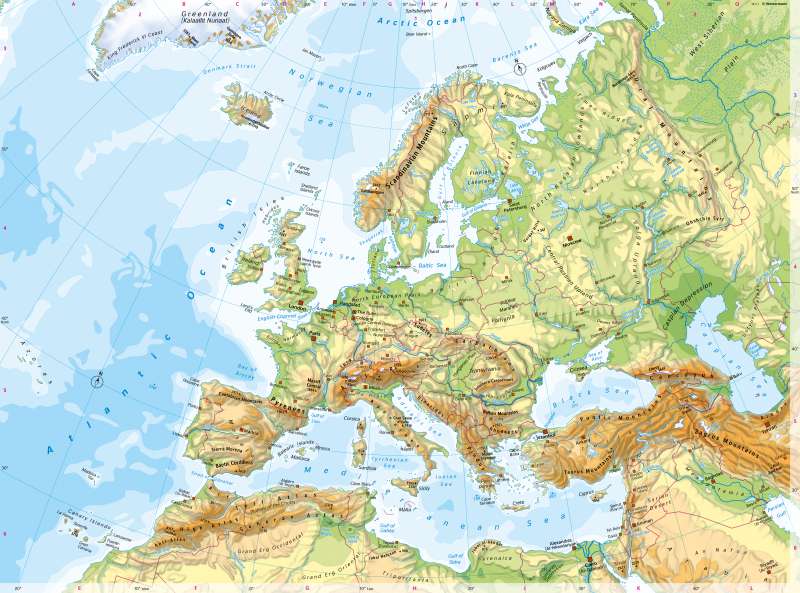
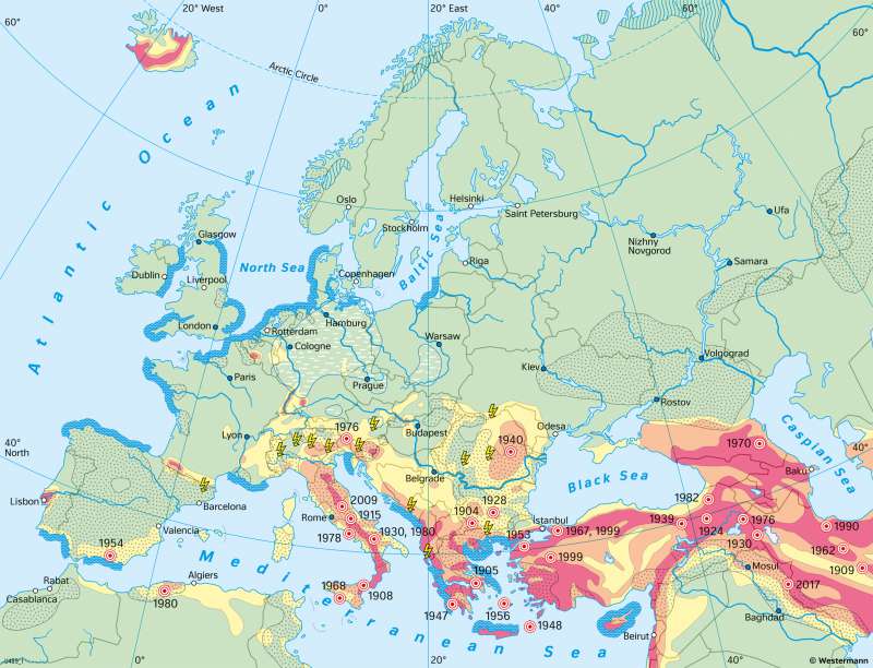
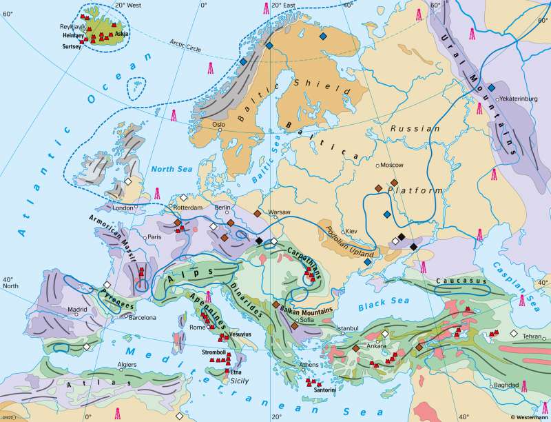
48 search hits for keyword: Europe

Maps

Europe - River basins

Diercke International Page 48 Ill. 1
Europe

Europe - Physical map

Diercke International Page 48 Ill. 2
Europe

Europe - Natural hazards and risks from climate change

Diercke International Page 50 Ill. 1
Europe

Europe - Formation of mountain ranges and deposits of natural resources

Diercke International Page 51 Ill. 3
Europe

Europe - Temperatures in January

Diercke International Page 52 Ill. 1
Europe

Europe - Temperatures in July

Diercke International Page 52 Ill. 2
Europe
show all 48 maps
Diercke Logo Footer
  • Start
  • My account
  • Legal notice
  • Contact us
  • General terms and conditions
  • Data privacy
 

Published by
Westermann Group
Georg-Westermann-Allee 66
38104 Braunschweig
Germany

Support
Our customer service will answer your questions about Diercke Premium or orders.
E-mail: onlineprodukte@westermann.de
Phone: +49 531 123 25 125

Social Media
You can find us here:

Diercke Weltatlas @Diercke Diercke Weltatlas

Marke des Jahrhunderts
© Westermann Group | Suche