
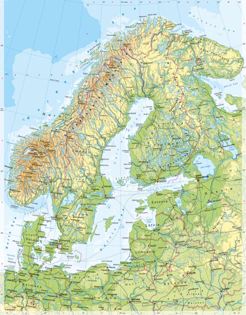
Scandinavia and Baltic States - Physical map
Physical map
978-3-14-100890-6 | Page 76 | Ill. 2
Overview
The Scandinavian Peninsula is more than twice the size of Germany. The distance between Malmö-North Cape is about the same as Malmö-Sicily. However, Sweden, Norway and Finland together only have about 20 million inhabitants, about a quarter of Germany. In large parts, the Scandinavian peninsula is therefore sparsely populated. Denmark, which is comparatively densely populated, is an exception in many respects. Large parts of the country lie on islands. With its widespread agricultural use, Denmark also contrasts with its northern European neighbours in terms of landscape - there, extensive forests and mountain regions dominate.
Geology of Scandinavia
The area now occupied by Sweden and Finland belongs geologically to the very old Baltic Shield. The Russian part of Karelia and the Kola Peninsula are even older geologically. The oldest rocks in Europe are found there - with an age of around 3.5 billion years. It forms a wide, flat uplift. The mountains, which folded up about 1.6 billion years ago, have been deeply eroded and are partially covered by young sediments at the edges. The Baltic Shield has shown a predominantly uplift tendency since the Precambrian. This uplift continues to this day due to the relief caused by the retreat of the Quaternary ice cover (uplift values of up to 11 mm per year). In the southeast, the Baltic Shield is bounded by a prominent break, marked by the Oslo Fjord, the Kattegat and the Öresund between Malmö and Copenhagen.
During the Caledonian mountain building around 400 million years ago, the mountains in the area of present-day Norway were folded onto the Baltic Shield, today's Skanden. They have the character of high mountains in parts and carry glaciers. Between the Skanden and the Baltic Sea, there is a north-west to south-east slope, which is particularly noticeable in northern Sweden due to the parallel course of the rivers.
Norway's coasts to the Norwegian Sea and the North Sea are highly indented and defined by fjords. The steep valley walls rise 700 metres or more from the water and at the same time reach more than 1200 metres below sea level. The valleys end in the form of a massive rock.
