
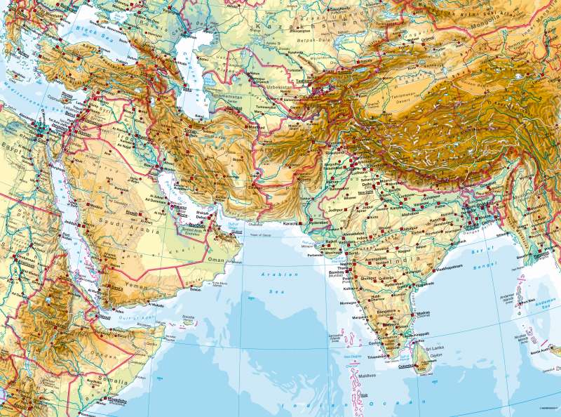
West and South Asia — Physical map
West and South Asia - Physical map
978-3-14-100790-9 | Page 98 | Ill. 1
Information
A wide belt of higher, geologically younger mountain chains runs through the map. In Western Asia the Caucasus and Taurus Mountains divide the Eastern European lowlands from Mesopotamia and the deserts of the Arabian Peninsula. In the highlands of Iran the belt of mountains experiences a broadening out, the interior of which comprises desert. North of Elburs and Kopetdag are the broad plains of Central Asia. The Himalayas mark the boundary between the Tibetan highlands and the Indian subcontinent, which is further subdivided into the river plains, the Dekkan highlands and the mountain chains of the Ghats. North of the Tibetan highlands, the Kunlun Shan mountain chain leads over to the geologically older mountain, highland and valley landscapes of Central Asia.M. Felsch; Ü: J. Attfield
