
South-East Asia — Physical map
South-East Asia - Physical map
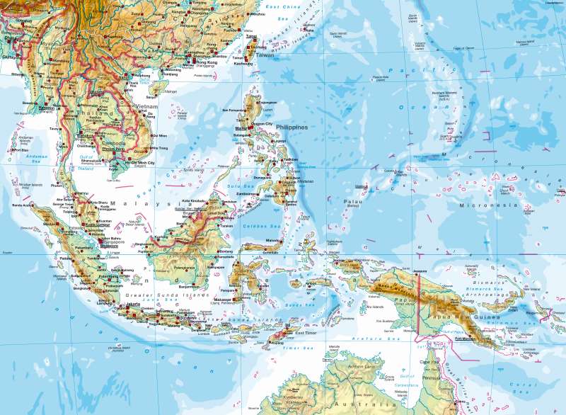
978-3-14-100790-9 | Page 112 | Ill. 1
Information
Southeast Asia comprises of countless, mostly mountainous islands, the Malacca peninsula and one mainland peninsula, which essentially includes Thailand, Laos, Cambodia, and Vietnam in the north.In the natural environment, there are clear distinctions between East, Central and South Asia because of the great mountain barriers and the climatic borders between the tropics and the sub-tropics
Specific to the interior of this geologically young, group of islands, which is located on a plate boundary, is a high prevalence of tectonic activity — be it as a result of volcanism, earth quakes or
crustal movement. As in the case of the Philippines, this mainly effects all tectonic plate borders that are located next to deep-sea trenches. By comparison, Borneo forms a relatively stable core. On large islands such as Sumatra there is a marked contrast between the considerably high reaching mountain ranges and the extensive, often marshy plains. While comparing the uninhabitable coast of Borneo with the fertile volcanic soils of Java, it is striking to see the extent to which natural conditions influence population density.
M. Felsch; Ü: M. Dahl
