Physical map
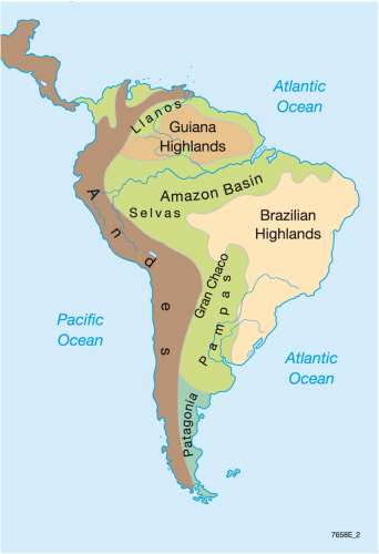
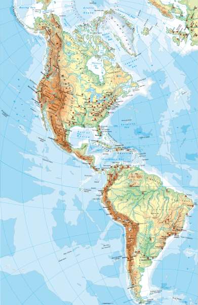
The Americas - Physical
978-3-14-100790-9 | Page 122 | Ill. 1
Information
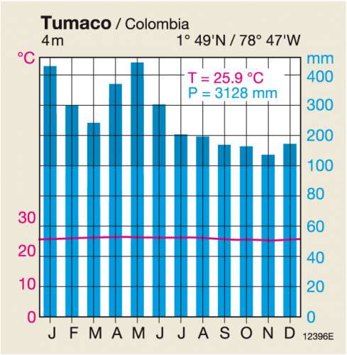
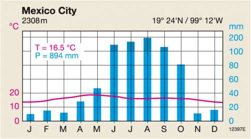
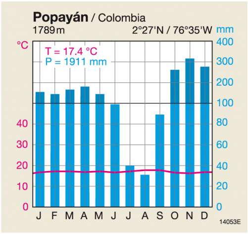
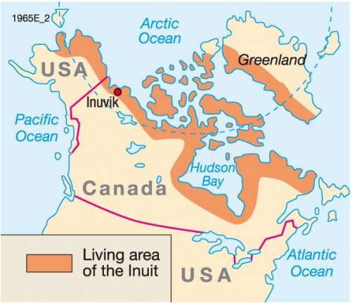
North America can be divided into three major regions. The geologically young mountain belt folds of the Rocky Mountains, with their striking north-south direction, has a sequel in South America and reaches their maximum width in the area of the Great Basin. It has been swaged to the geologically old and stable American plate, with its wide open spaces (Great Plains) to the east. The waters there are marked guidelines (the lake chain from Bear Lake to Lake Erie, Hudson Bay, St. Lawrence River, Mississippi). The island groups in the Arctic Ocean and Greenland make up the third major regions.With the very high, geologically young Cordilleras in the west, the vast plains with their enormous power systems inland and the lower geologically ancient mountains in the east (Amazonian Shield, Guyana Shield), large similarities to North America exist in the geological structure and relief in South America. However, climate and vegetation are completely different due to the location in the tropics (with the exception of the south). In spite of the altitude, the Andes are of the oldest settlement areas and preference for living there has has not changed to this day (see Colombia). Settlements are otherwise, in most states, more coast orientated (see Brazil).
M. Felsch; Ü: Colette Fleming
Graphics