
Greater Mumbai - Satellite image
Monsoon and regional disparities
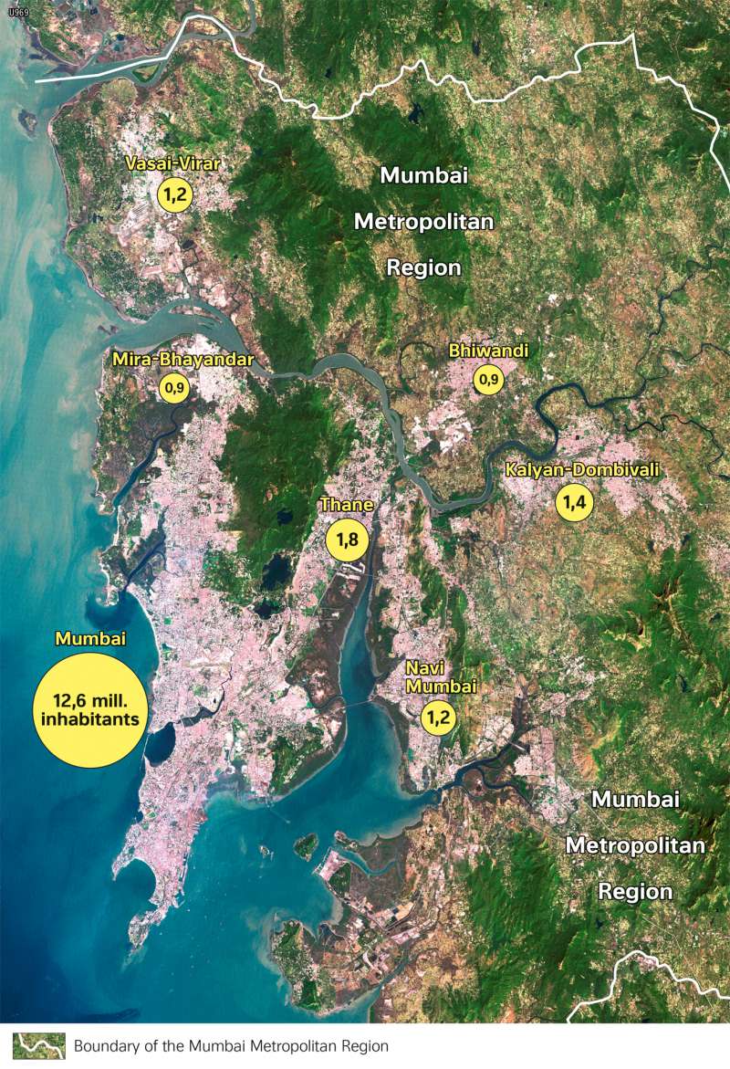
978-3-14-100890-6 | Page 122 | Ill. 2
Overview
With more than 12 million inhabitants (21 million in the agglomeration), Mumbai is the largest city in India before Delhi and at the same time the most important financial and economic metropolis, the largest port in the country and an important cultural centre with many universities and large film studios ("Bollywood"). The connection to international traffic is excellent.
Urban structures of Mumbai
Mumbai's urban area is highly structured. This is due to the special natural conditions. Mumbai (Mumbai City and Mumbay Suburban District) is located on the approximately 620 square kilometre island of Salsette, which is somewhat smaller in area than the urban area of Hamburg (755 sq. km). The population of Mumbai, however, is about 7 times larger than that of Hamburg. This explains the extremely high population densities in Mumbai (around 20,700 inhabitants/sq. km; for comparison: Hamburg 2400 inhabitants/sq. km). Salsette is separated from the mainland by Bassein Creek and the Ulhas River in the north and Thane Creek in the east. The northern part of the island has a low mountain range character, is forested and protected as a national park. In the northwest and east there are extensive swamp areas. All three areas stand out as uninhabited in the satellite image due to their green colour.
The Mumbai Metropolitan Region includes other extensive settlement areas such as the megacities of Thane, Navi Mumbai (a satellite city built in the 1970s to relieve congestion in the core city) and Kalyan-Dombivli. With an area of around 4355 square kilometres, the metropolitan area is equivalent to about one tenth of Lower Saxony, its population roughly that of Lower Saxony, Hesse, Schleswig-Holstein, Hamburg, and Saxony-Anhalt combined.
