
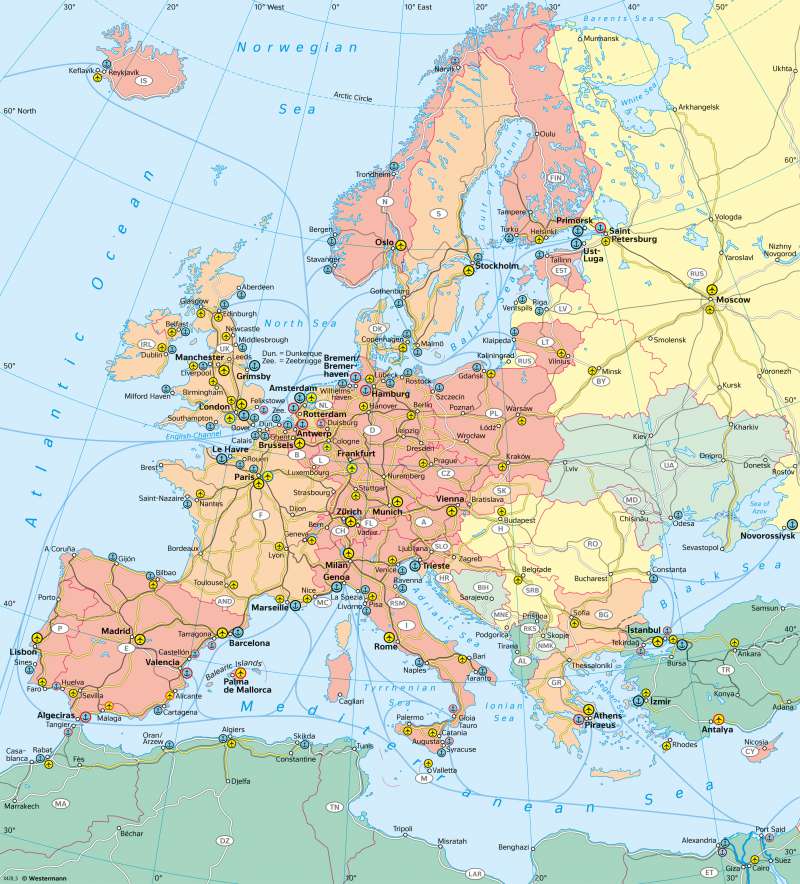
Europe - Interregional transport
Transport
978-3-14-100890-6 | Page 72 | Ill. 1
Overview
Efficient transport hubs and networks are a necessary prerequisite for a highly developed region and its economy. The greatest variety of modes of transport, numerous individual locations and the greatest network density can be observed in the densely populated economic core area of the EU. In peripheral regions, transport is usually limited to a few locations and routes.
Road traffic
In terms of car density, there is a contrast between two areas: Western, Northern, Central and Southern Europe on the one hand, and the new EU member states, South-Eastern and Eastern Europe and Turkey on the other. The only exceptions are the Czech Republic and the Baltic states of Lithuania and Estonia with a comparatively high car density. This is based on the history of these areas - in the former COMECON states, car density at the time of the political turnaround in 1990 was significantly lower than in Western Europe. Additionally, the level of economic development and the income of the population are important factors. This division can also be observed when looking at the major highways.
Peripheral transport corridors
The central transport corridor of the EU is connected to several main axes leading into less central, peripheral regions of Europe, such as:
- to Southern France (Rhône rail),
- Northern Italy (see also map 54.2 "Alpine transit"),
- Scandinavia (via Hamburg - Copenhagen/Malmö),
- Eastern Europe (via Hanover - Berlin - Warsaw/Krakow), and
- Southeast Europe (via Stuttgart - Munich - Vienna - Budapest).
In the Mediterranean region and on the Black Sea there is an orientation towards individual locations along the coasts with seaports and airports, from which long-distance roads and railway lines provide access to the respective hinterland. More difficult conditions for transport development arise in strongly peripheral locations (e.g. in northern Scandinavia), for island states (such as Iceland), if the respective country is very large in surface (e.g. Russia) or the relief is very mountainous (e.g. Italy).
Central transport corridor
The map shows the central transport corridor as a strip extending from the south of England to France, Paris and the Benelux countries along the Rhine corridor and also includes the north-west German coastal locations of Bremen and Hamburg. This space corresponds to parts of the Blue and Yellow banana in economic geographic space models. The central transport area of the EU contains:
- six major airports (including the four largest on the continent)
- several maritime transport hubs (including the four largest on the continent)
- the largest inland port in Europe (Duisburg)
- numerous inland waterways
- the continent's densest road and rail network (especially the backbone of the high-speed rail network).
Elaborate structures such as the 50-kilometre-long Eurotunnel opened in 1994 between France and England underline the importance of this area.
