
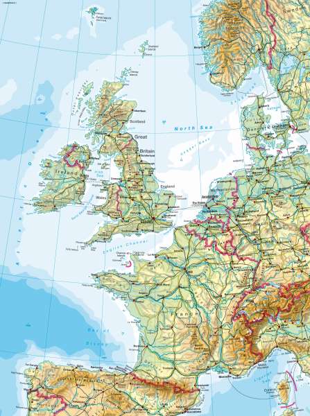
Western Europe — Physical map
Western Europe - Physical Map
978-3-14-100790-9 | Page 64 | Ill. 1
Information
France comprises wide-ranging flat to hilly lowlands, basins and plateaus, which are clearly delineated by the Atlantic and Mediterranean and by the Pyrenees, Alps and Vosges mountains. Only the Massif Central and the Cevennes mountain ranges in the south reach greater heights. Between the Vosges and the Massif Central on the one side and the Jura and the Alps on the other side is a broad rift zone, which is followed by the rivers Saone and Rhône. North of the Ardennes, in the region of the mouths of the Rhine, Maas and Schelde, a broad transition zone to Central Europe exists.Great Britain is characterized by the contrast between the flat, rolling, scarp landscapes of south-east England and the Caledonian or Variscan highlands of the Pennines, the Scottish Highlands and the Cambrian Mountains. Ireland displays similar contrasts.
M. Felsch; Ü: John Attfield
