
Northern Africa — Physical map
Northern Africa - Physical map
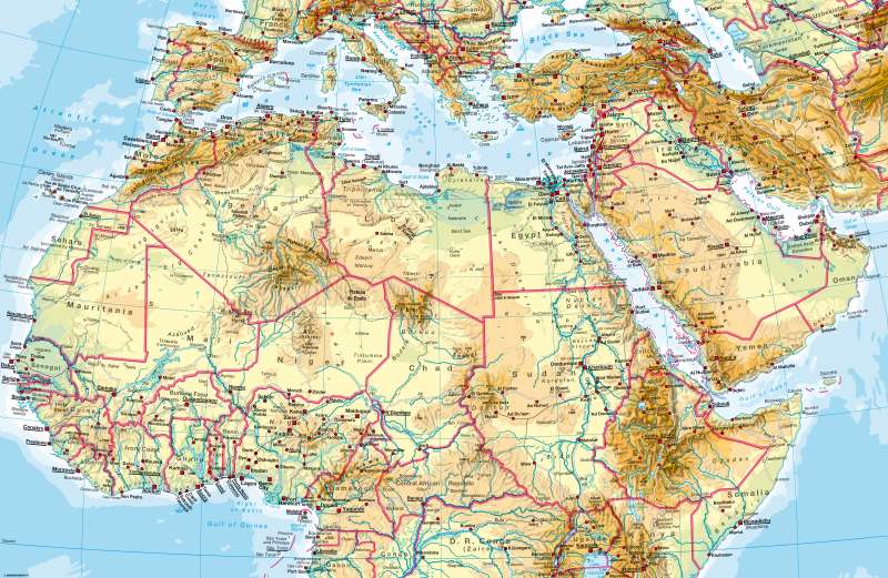
978-3-14-100790-9 | Page 162 | Ill. 1
Information
This map clearly shows the large desert regions of northern Africa and West Asia and rivers such as the Senegal, Nile, Chari and Niger, all of which are lifelines of these regions. In addition to the coasts, the rivers form the main lines and nodes of settlement in the north of the continent. The patterns of settlement are more homogenous south of the Sahara in the wet-dry and wet tropics.The geographical relief of the inner part of the continent is characterised by basins and swells. The river system is aligned with the basins (compare rivers flowing into Lake Chad, the Upper Nile Basin (Sudd) and the Congo Basin). Wadis and salt pans are typical examples of forms found in large deserts. Particularly striking is the former shoreline of Lake Chad (represented here by a dashed line), which has greatly decreased in size as a result of anthropogenic influences and constant droughts. The shoreline of the very shallow lake changes annually relative to regional precipitation and inflow. Another striking landscape is the Interior Delta of the river Niger in Mali south of Timbuktu. It is influenced by the seasonal flooding of the Niger and its tributaries and also a widely spread network of waterways.
The highest altitudes in the north of the continent are reached in the eastern highlands and mountainous regions, in the Atlas Mountains as well as in the central ranges of the Sahara (Ahaggar, Tibesti). The Ethiopian Highland connects the rift system of East Africa with the Red Sea.
M. Felsch; Ü: J. Moar, M. Dahl
