
Agriculture
Africa - Agriculture
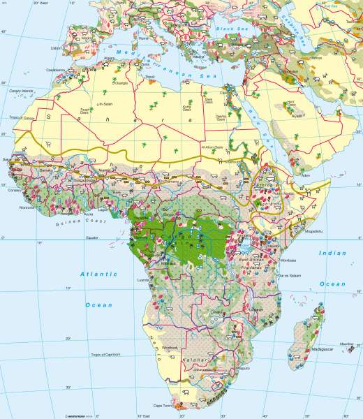
978-3-14-100790-9 | Page 158 | Ill. 1
Information
Very different forms of agricultural utilisation coexist due to naturally occurring diversity and historical development. The map provides an overview of land use, the expansion of cultural and pasture lands and cultivated crops which also relate in many respects to the climate and physical maps. However, the map gives no information regarding other important factors of agriculture such as farm structures, the way of farming and ownership. Statements on export orientation are drawn from the hachure (derived personal use) or indirectly from the crop cultivation.Cultivation zones
The map is based on the alignment of the latitude vegetation zone between the Sahara and the Lunda threshold. In the evergreen rain forest of the Congo Basin and the residual West African monsoon forest, a moist savanna belt follows linking to a wide zone of dry and thorn bush savanna. The Sahara Desert and semi-desert reach the extent of a "continent" and the Horn of Africa, East and South Africa are part of the coastal zones and desert-like inland regions. The highlands of Ethiopia and East Africa show a vertical landscape which divide into altitudinal zones.
The agro-ecological structure of Africa provides a framework for the distribution of livestock. The Savanna and lowland rain forests are infested by the tsetse fly, therefore large-scale cattle farming is not possible. The dry tropics, the altitude regions of the tropics and semi-arid to humid sub-tropics are main areas for livestock. The degree of market orientation in the livestock sector is very diverse.
Livestock such as sheep, camels and donkeys in North Africa are now essential commodities, along with cattle, goats, sheep and donkeys in the savannas and plains, with goats, pigs and poultry important in the rain forest region.
The zonal alignment of climatic zones and their altitudinal zonation is reflected in the spread of crops. Among the food crops are cassava and plantain in the forest zone, yams, millet and groundnuts in the dominant dry and thorn bush area of the savannas. Rice cultivation on irrigated land plays an increasing role. Wheat cultivation is most commonly grown in the subtropical winter rainfall regions and dates are grown in the subtropical and tropical semi-deserts and deserts. In the highlands, maize, beans and sweet potatoes are a staple food. The oblique hachure (on the map) characterises not only the agricultural crops produced for domestic needs, but also those produced, to a considerable extent, for the local and regional markets.
The mainly export-oriented crops are classified on the basis of landscape and altitudinal zones: fat supplying oil palm plants in the rain forest zone, stimulants plants cacao, coffee bushes and Hevea brasiliensis trees for the supply of rubber. The savannas are cotton and peanut regions. In the higher areas, shrub cultures provide valuable Arabica coffee and tea. Mediterranean crops such as citrus fruits and wine grapes are grown in the extreme north and south of the continent.
To the north of the Sahel, dry regions determine the conditions for agriculture which are bound by the local groundwater resources and the Nile (oasis agriculture). Agriculture is only possible without irrigation in isolated areas north of the Atlas Mountains and at the Mediterranean. Despite the close geographic boundaries of the regions, agriculture in this part of Africa is a very productive and an important economic factor.
B. Wiese, M. Felsch; Ü: C. Fleming
