
Russia/Central Asia — Physical map
Russia/Central Asia - Physical map
978-3-14-100790-9 | Page 86 | Ill. 1
Information
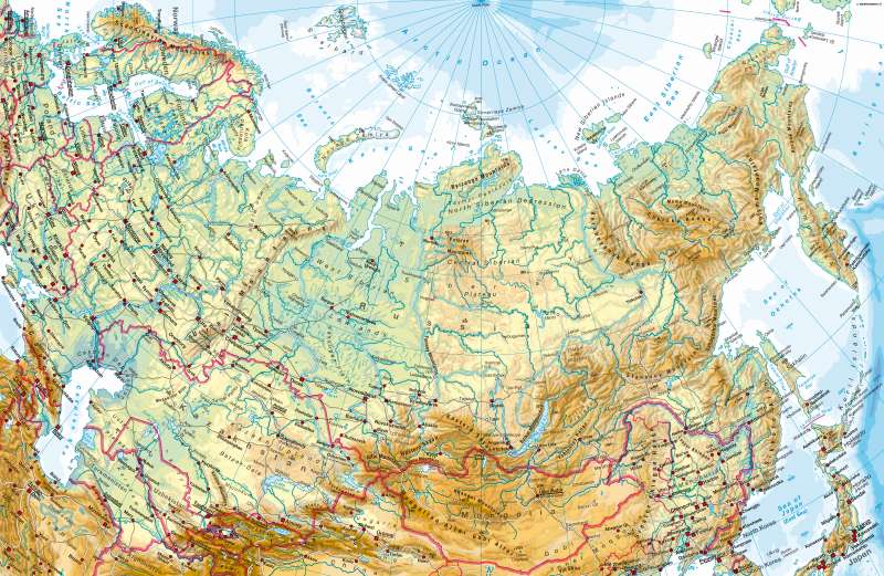
North Asia ranges from the shores of the Arctic Ocean to the Kazakh threshold, the edge of the highlands and mountains of Central Asia basins (Altai, Sayan, Jablonowyi) in the south. It also ranges from the Urals in the west to the Pacific Ocean in the east. Its surface formation is divided into three parts:-apart from West Siberian Plain between the Urals and the Yenisey which were formed in the Paleozoic era- the geologically ancient mid-Siberian hills between the Yenisei and Lena (the Central Mountains, Angara Shield) and the young chain of mountains east of the Lena (including Sikhote-Alin and Kamchatka) which have some active tectonics. The islands in the Arctic Ocean and the bulk of the coastal plains, whose form rarely reach to far extents, separate the spatial units. Tundra and boreal forests in western Siberia and extensive swamps characterise the vast landscape, which, with the exception of the Southeast, is sparsley populated and barely developed.A: M. Felsch; Ü: C. Fleming
