
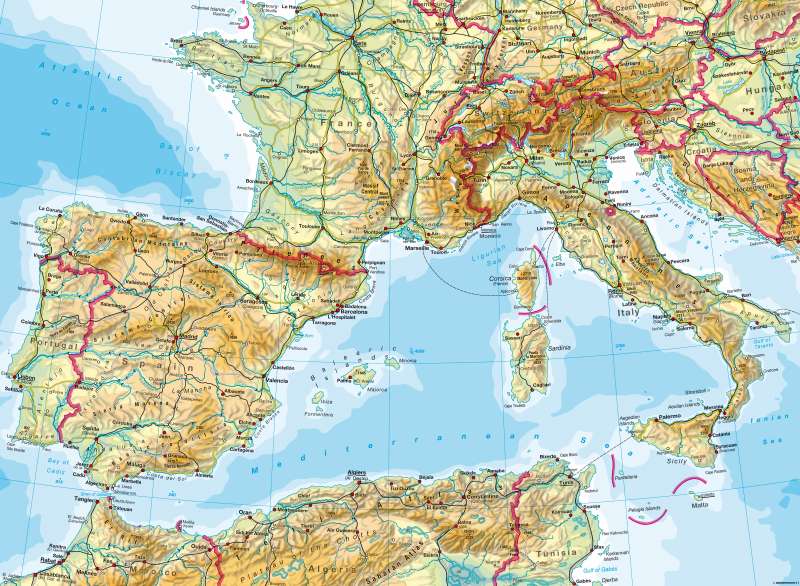
South-West Europe — Physical map
South-West Europe - Physical Map
978-3-14-100790-9 | Page 74 | Ill. 1
Information
The south-western Mediterranean region is governed by the coexistence of highlands and the Mediterranean Sea and surrounding islands.The older mountains are from the Hercynian phase (Massif Central in the heart of the Iberian Peninsula, the highlands of the bulkhead). Closely interlocked are the young mountains of alpidischen phase (Cordillera, Pyrenees, Alps, Apennines, Er-Rif, Atlas). As the Mediterranean Sea lies between the European and North African mountains, the islands are consistently attributed to the alpidic orogenesis. In some cases, their active volcanoes also indicate active tectonics, such as severe earthquakes (see 79.3). Nestling between the mountains are the great plains (Po), trenches (Rhone), valleys (Ebro), or far-flung basins (Castile) which are of particular importance for the population and economy, as are the broad coastal areas.
A: M. Felsch; Ü: C. Fleming
