
Northern Europe — Physical map
Northern Europe - Physical Map
978-3-14-100790-9 | Page 60 | Ill. 1
Information
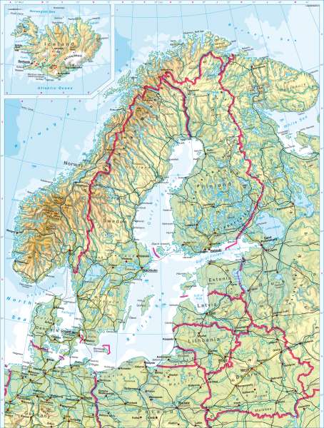
In Scandinavia, north-south oriented geological structures (ancient supercontinent and remnants of the Caledonian Mountains) are overlaid with a climatic zoning from north to south and a differentiation according to altitude. The Scandinavian Mountains in the west and north-west contrast with the basins of the Baltic Sea and the largely flat landscapes in the east (south Finland) and south (Jutland, south Sweden). In part the Scandinavian Mountains have an alpine character and contain glaciers. Connecting the Scandinavian Mountains to the Baltic Sea is a slope oriented to the north-west and south-east, which is striking due to the parallel course of the rivers especially in north Sweden.During the last Ice Age the area of Scandinavia was covered by inland ice. As a result the surface forms at the coasts, in valleys and on the plains show many traces of glacial and periglacial action. The wealth of lakes is also a result of this.
A special position is occupied by the island of Iceland, not only on account of its northerly situation (tundra vegetation). The Mid-Atlantic Ridge runs through the island and causes active tectonic and volcanic activity (geysers).
M. Felsch; Ü: J. Attfield
