
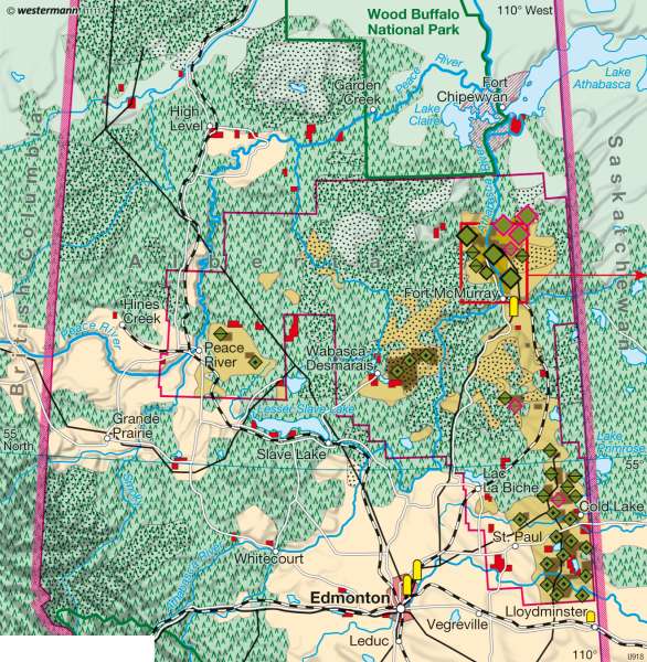
Athabasca (Alberta/Canada) — Landscape change and CO₂ emission from oil sands extraction
The world - Environment
978-3-14-100790-9 | Page 199 | Ill. 4
Information
The mining of the oil sand deposits in the Canadian province of Alberta, with its some 3.3 million inhabitants (2006), was long regarded as not economically viable. But today, against the background of rising world energy needs and the increasing shortage of conventional oil reserves, the question arises of whether the oil sands of Alberta could not become important as an economically interesting and at the same time both ecologically and socially acceptable alternative that could significantly extend the lifetime of exhaustible energy raw materials.Map Contents
The map shows not only the situation of the oil sand deposits and the existing or planned mining areas in the geo-zone of the boreal coniferous forests in the northern part of Alberta, with its sparse population and scattered settlements, but also the mining and extraction technologies that are used. The available infrastructure for transport and further processing in the form of pipelines and refineries can thus be identified. In addition, the contents of the map also make it possible to draw conclusions regarding the land use conflicts that arise and the ecological effects of oil sand mining on the landscape in Alberta. These include the incursions of open-cast mining into the territory of the boreal coniferous forest, the threat to the Wood Buffalo National Park by pollution of the Athabasca River and, not least, the possibly negative impact on the caribou population. The closeness of the mining or extraction areas to Indian reservations also ra
