
The world's extreme climates
The world - Climate
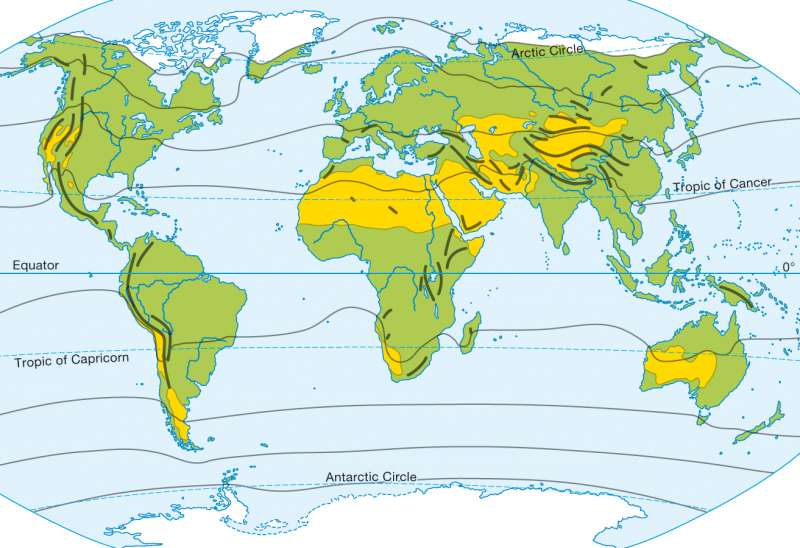
978-3-14-100790-9 | Page 176 | Ill. 2
Information
The climate maps represent the spatial dispersion of the systematic climatic ratio on the Earth. Therefore, they provide a good overview of the key climate characteristics of a region. For reasons of content and didactic reduction, only a few climate parameters are taken into account. It is only possible to typify and classify, despite the continuous changes of the climatic conditions on earth abstractly affected by the climate. As a result, climate classifications are an important basis of geographical spatial analysis.Hygric Climates
Helped by the number of humid months, different humidity and aridity grades can be distinguished. The hydrology is thereby based on Lauer/Frankenberg's scientifically substantiated humidity concept. This compares the monthly precipitation (N) of the corresponding sum of potential landscape evaporation (PLV) to the actual physical precipitation contra size. In this way, the climatic hydrological balance of an area can be accurately quantified. Here, the PLV is reached on the basis of the potential evaporation of free water level (pV) and one charge of vegetation and land type, dependant conversion factor (Uf) to the equation pLV = pV?Uf calculation.
Reaching or exceeding a month's precipitation amount, with the corresponding value of potential landscape evaporation (N ? pLV), would be defined as humid. In the opposite case, (N < pLV) this would be defined as arid. Through the amount of humid months, one can frame the classification concept of four different hygric climate types. The individual humidity or aridity classifications are abbreviated by the lowercase letters a (arid), sa (semi-arid), sh (semi-humid) and h (humid).
arid (a): 0 to 2 humid months.
semi-arid (sa): 3 to 5 humid months.
semi-humid (sh): 6 to 9 humid months.
humid (h): 10 to 12 humid months.
A. Siegmund; Ü: C. Fleming
