
Southern Africa — Physical map
Southern Africa - Physical map
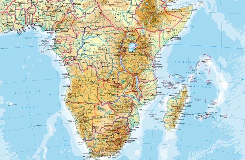
978-3-14-100790-9 | Page 164 | Ill. 1
Information
Most of South and East Africa lies at a relatively high altitude (Eastern Highlands). Large plains are located on the east coast along the Indian Ocean.The southern part of the continent is made up of a very ancient and tectonically stable shield. It is divided into basins and swells (e.g. Lunda Swell, Kalahari Basin) whereby the ranges surrounding the basins are very high in parts (e.g. Drakensberg range). This sub-region stands in contrast to the highlands in the east that are shaped by active tectonics and rift valley structures.
The waterways are determined by the structure of the surface (the river basin system of the Congo, the rift valley lakes, and in the Kalahari Basin: Wadis and the Cubango River which terminates in an interior delta). The contrast between the east and west coast is also very striking (refer to notes on climate). It is caused by very diverse climatic conditions. Whereas the east coast is upwind from the trade winds and therefore subject to regular and high rainfall, the west coast is dominated by winds that flow parallel to the coast and the cold Benguela current and therefore experiences very low precipitation.
The highest peaks in the south of the continent are Mount Kilimanjaro and the other large volcanoes of East Africa, but also parts of the Drakensberg range.
Madagascar and the surrounding archipelago form an independent sub-region.
M. Felsch; Ü: J. Moar, M. Dahl
