
British Isles — Physical map
British Isles - Physical map
978-3-14-100790-9 | Page 14 | Ill. 1
Information
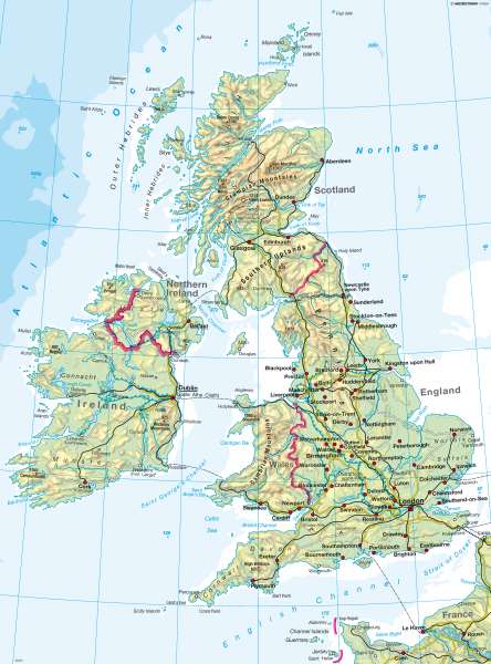
Natural spaceGreat Britain exhibits a highly complex topography. Mountain ranges, high plains, uplands and coastal plains give rise to a wide range of landscapes. The country is roughly divided along a line extending from the Blackdown Hills in Devon to the North York Moors in the North-east of England. The landscape to the west and north of this line is dominated by mountains and highlands, while the region to the south and east is characterized predominantly by flatlands.
Altogether, roughly 70 percent of the territory of Great Britain is classified as mountainous. Most of the numerous moors are located at elevations higher than 400 m.
Landscape forms
A number of mountain ranges interspersed with basin landscapes shape the topography of Scotland, Wales and parts of England. Aligned from north to south, the uplands of the Pennines in central England mark the boundary between the mountainous region and the lowlands in the East and South.
The highest peaks are found in Scotland. Ben Nevis in the Highlands reaches an elevation of 1,343 m. Mount Snowdon (1,085 m) in the Cambrian Mountains is the highest point in Wales. Slieve Donard (852 m) in the Mourne Mountains is the tallest peak in Northern Ireland. The Cumbrian Mountains in north-western England rise to a height of 978 m.
Hilly flatlands and coastal plains define the landscape of eastern England. They are crossed by isolated chains of hills (e.g. the Hambleton Hills in York, the North Downs and South Downs south of London).
The coast of Great Britain is
