
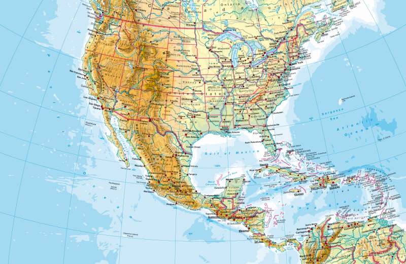
United States and Central America — Physical map
United States and Central America - Physical map
978-3-14-100790-9 | Page 138 | Ill. 1
Information
North America can be divided into three major regions. The geologically young mountain belt folds of the Rocky Mountains, with their striking north-south direction, have a sequel in South America and reach their maximum width in the area of the Great Basin. It has been swaged to the geologically old and stable American plate, with its wide open spaces (Great Plains) to the east. The waters there are marked guidelines (the lake chain from Bear Lake to Lake Erie, Hudson Bay, and St. Lawrence River, Mississippi). The island groups in the Arctic Ocean and Greenland make up the third major regions.M. Felsch; Ü: C. Fleming
