
East Asia — Physical map
East Asia - Physical map
978-3-14-100790-9 | Page 106 | Ill. 1
Information
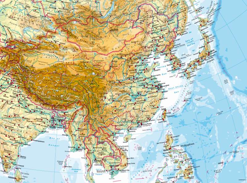
The physical character of Eastern Asia is determined by the contrast between the mountains, highlands (Tibet) and desert basins (Gobi, Tarim, Qaidam, Dzungaria) of Central Asia on the one side and the fertile and heavily-populated Great Plain. The deltas of the great rivers, especially the Mekong, are comparable with the Great Plain as areas favourable to settlement. Within the mountain chains, the heavily-populated Sichuan Basin ("Red Basin") takes on a special position.Towards the coast the mountains of Eastern Asia are lower, but still attain considerable heights (Annam, Wuyi Shan). The Korean Peninsula and the island of Taiwan have a decidedly mountainous character.
The interior of Japan, which is also mountainous, is largely covered by forest, and only the floors of some of the river valleys are used for agriculture. There are only a few coastal plains — for example around Tokyo — and a relatively narrow coastal fringe, with the result that the area of settlement is restricted and moreover strongly competes for land with agriculture. A special problem for Japan is the threat of earthquakes. The active tectonics is also clear from the number of volcanoes.
M. Felsch; Ü: J. Attfield
